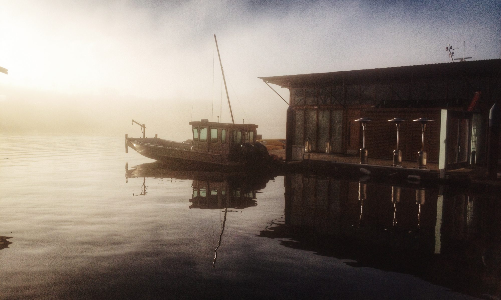
Lions Gate to Mount Seymour on highway/Mt. Seymour Parkway.
Mount Seymour to Deep Cove on Mt. Seymour Parkway
Deep Cove to Lonsdale on Dollarton/Main st/Low Level Rd/Esplanade
Lonsdale to Park Royal on 3rd/Marine dr.
So, mostly on the southern/coastal parts of north shore. Holy traffic!! I don’t know how anyone could stand to drive this everyday. It’s just a giant parking lot, once you’re west of the Second Narrows.
Some observations:
Cycling infrastructure is scary AF. Sharrows that disappear, giant trucks, narrow lanes, nothing separated. & yet counted some 50-odd cyclists braving the roads I drove today.
There’s some really interesting mid-rise densification happening everywhere west of Second Narrows (apart from along Low Level Rd)
The current streets appear to be full already: I don’t envy transportation planners on the North Shore.
Lonsdale itself is just BEGGING for better mixed-use infrastructure: a cycle track, a street car, something. It’s a beautiful street, only way too car-dominated for what should a be a slow, shopping/ambling street.
There seems to be both enough density & more importantly a hugely dense commercial base to warrant some sort of LRT between Lonsdale & Park Royal: streetcar? Tram? Something. Maybe take out a lane of traffic, or street parking (most mini malls appear to have that) & add in rails & a cycle track? Open the city to more exploration!
Entering/exiting at the bridges has VASTLY improved compared to just a few years ago.
Busses must suck: I saw 3 the entire width of the north shore & all were just as stuck in traffic as I was. Bus lanes?
In mid-August, we strapped the bikes on the back of the car, the kids in their seats and drove out to Kelowna. There, we picked my parents up from the airport, then headed south down highway 33 to Idabel Lake. They dropped Leah and I off, and took the car & the kids to a house they’d rented near Oliver. It was just us, our bikes & 5 days.
Despite the “circuit” being from Midway to Penticton, we had decided that we’d like to start at the top of the climb, and so skipped the Midway-Idabel stretch. This turned out to have been a particularly good decision for 2 reasons:
Leah was recovering from pneumonia, and still has nothing like full lung capacity: indeed, on our very first climb, she was breathing hard & needed to use her puffer. Fortunately, that turned out to be the hardest climb of the trip.
We ran into a group of 4 riders who had ridden that stretch, and told horror stories of how difficult it had been: steep, technically challenging and in a bad state, maintenance-wise .
& so we set off from Idabel lake, with our destination for Day 1 being Chute Lake, some 74km away.
Idabel Lake – Myra Canyon
This first part of the trail was gorgeous, easy riding. The trail was pretty smooth, with only a few muddy sections or a few super-rocky sections. Really a great into, riding through pine forests & around lakes, emerging with fantastic views down towards Kelowna as we neared Myra-Bellevue Provincial park. It was also blissfully quiet – we didn’t see a single other rider the whole time – only 1 man in a fishing boat & some horses.
Myra-Bellevue Provincial Park
This is the raison d’être of the trip: the trestle-bridges of the park. It certainly is gorgeous – and will only get more so as the region recovers more from the 2006 fire that destroyed most of the original bridges. The restoration is impressive, and it is well worth the trip to ride or walk this stretch: it’s about 12km in length, and you’ll cross 18 trestle bridges and go through 2 tunnels in that stretch. For better or for worse, this part of the trail is crowded. There are several tour groups running daily trips out from Kelowna, and so yes it’s busy. But it also lives up to all the hype – and can easily be walked or biked at really any level of experience.
Myra-Chute Lake
This part kind of sucked. For the most part, this stretch follows an old forestry services road that is in serious need of maintenance. If you’re not on a fat-tired bike with suspension, it’s not a lot of fun. You also end up going through a bunch not scrubland without a view. On the flipside, you also get some spectacular views of Kelowna and one last trestle bridge that is truly stunning. But boy were we glad when we finally reached Chute Lake Resort. Which is almost worth a post itself. It’s a charmingly kitschy old hunting lodge, with a very limited menu, but it has cold beer & dank showers, and what more do you want after a long, hot ride? Fun side fact: with a wood/clapboard construction, you can hear everything going on in every other room. Through the gaps in the floorboards of our room, I could see the dining room below. But, a fun place.
Chute Lake – Penticton
This stretch contains both the roughest stretch of the trail, from Chute Lake to ‘the little tunnel’, and the most stunning, from the tunnel to Penticton. Again, a fat-tired suspension bike strongly recommended due to thick, loose sand and lots of rocks along this stretch. But then you go through the tunnel and it becomes perhaps the most amazing, beautiful trail I’ve ever ridden, through down along the lake through vineyards and orchards right into the Penticton lakefront. This was the stretch that one of my tires finally blew out, somewhere just after the Adra Tunnel. It was also relentlessly hot, as there’s virtually no cover. On the flip-side, this section is 58km, almost entirely downhill.
Penticton – Okanagan Falls
We spent an extra in Penticton, staying at a lovely B&B right on the lake, and spent the day lazing down the Penticton channel in inner tubes, and eating dinner at a newly opened Brewery there, Bad Tattoo Brewing (brief review: excellent pizza, their darker beers are their better beers, all good). We then rode on to Oliver, taking the KVR route along Skaha Lake through Okanagan Falls. Signage here was an issue, as getting from Penticton on to the KVR along Skaha was not at all signed – it ends up you ride through a trailer-park campsite with a sign saying “no public access” – just ignore that and keep the lake on your left. The Skaha lake trail is very sandy – I had to walk my bike a fair bit, although Leah, with fatter tires, was fine, but really, really lovely. I could imagine really enjoying spending more time either in OK Falls or Kaleden. The bridge into Okanagan Falls, pictured above, contains a gate midway through, through which kids were jumping into the lake then climbing back out. Well worth a stop, I would think.
Okanagan Falls – Oliver
This stretch is true “wine country”, and there’s little need to follow the official KVR trail – what little of it exists & is signed, particularly if you want to ride from winery to winery tasting things. The only downside is a 15km stretch alongside the highway – one with a nice, wide shoulder to ride in, but after been so far from traffic for so long, a bit of a let-down. This stretch also is quite hilly if you want to ride up to the wineries. Trust me – you want to ride to the wineries. We stayed our last night at 6 Road B&B just south of Oliver – again, spectacular, nestled into a working Orchard, and conveniently only a few-minute ride up to Tinhorn Creek Winery and Miradoro restaurant, where we ate dinner our last night out.
Final Notes:
Don’t ride this trail without a fat-tired bike. Tires & suspension are much more important than gears – I barely changed gears the whole trip outside of the climbs around Oliver, as it really is mostly a 2% grade.
Take more water. We had 2 water bottles + a spare each, and it wasn’t enough. It gets damn hot in the Okanagan, and you’re exposed most of the time.
I regret not having a GoPro to take some video of the route – my makeshift camera-on-a-gorilla-pod didn’t cut it.
I bought a handleband to hold my phone for this trip, which was awesome. I totally recommend it. I’d also recommend extra battery packs for long rides, which I didn’t have.
I wish we’d had another day to ride further south down to Osoyoos and explore that last stretch.
Definitely add this to your bucket list. Apart from our first 74-km day, I could imagine Liam doing this trip without too much trouble, so consider it kid-friendly, if you’re willing to take it slower.
I just backed the XOXO Festival on Kickstarter. It seems amazing, its local(-ish), and when I first read about it, it seemed like something I’d regret not going to, if I didn’t. I don’t actually know if I can go at this point – Leah’s work schedule will dictate that. But I’m going to try. & it’s in Portland, where I’ve never been, but keep meaning to get to. So. 3 things checked off my bucket list: 1) first time backing a project on kickstarter 2) first time going to Portland 3) attending a non-directly-work-related conference because the topic is cool.
I want to preface this by saying I love the idea of the Eastside Mural Tour project, for so many reasons: I love Vancouver’s art, particularly the hidden, surprising art. I love graffiti art. I’m a fan of community projects, and projects that celebrate them. I’m also particularly interested in the idea of digitally curated physical objects, and finding new ways to help travel, explore, learn about communities online. That being said, I’m really disappointed with this project – they’ve missed some really simple points that I feel are critical. If you’re a developer on this project, please don’t think I’m shitting all over you for no reason: if you’ll let me, I would gladly pitch in to help.
All that out of the way, here’s the misses:
The site doesn’t really work on Mobile. Load the front-page: the interactive map is done in flash. The site itself isn’t optimized in any way for a mobile experience: but this is a site destined to be used by someone on a device; most likely as their doing their tours.
The most prominent links are to PDFs of the tours; the big, colourful buttons on the right side. However, hidden at top at HTML versions of the descriptions, which actually contain descriptions of the art!
On these HTML pages, there’s no Map of the location. Nor is there any “next stop/previous stop” links to guide my usage of this. Nor do these HTML pages contain the dial-in directions that the PDFs do
The PDFs are not styled in any way, nor do they contain any of the useful descriptions of the stops on the tour – instead, they simply contain titles of the art, in a format that appear to be links, but if they are, did not work for me in any way.
This one strikes me as particularly egregious: The PDFs contain an image of a Google map that contains all the stops on the tour. So someone clearly spent some time building the geo-coded tour – why not embed that map?
No social: Why not at least propose a couple of hashtags for the project, per tour, maybe per site. Pull in comments/photos from Instagram, Twitter, Foursquare to let the community participate in this beautiful project, in this art. Pinwheel is brand new, but given Caterina‘s local origins, they might be very interested in participating.
Data: I couldn’t find these mural’s in Vancouver’s Data set (though maybe I just failed in my search), but why not, given you clearly have all the geo-data for these murals, release that data for others to remix?
There other, smaller quibbles, but those top 5 strike me as major faults that we should fix. The last simply betrays my personal bias towards open data, and in particular, location data.
There’s also some other ways this same sort of tour could be made. There’s a site, MapTales, that exists solely to create these sorts of self-guided tours. I don’t think it should replace the current site, but providing links to another interface would be a nice way to share these tours out in a well-designed, contemporary way. Bringing up Pinwheel again, all of these stops could exist in there. I don’t think they have the idea of “tours” currently, but by creating a hashtag, locating these places, this could open up the ability to extend & comment on by the pinwheel community. I’d also recommend creating “places” in Foursquare for each of the stops on the tours, let people check in there – or at least easily geolocate photos taken there in such a way that the project itself can re-use them.
This project is sub-titled “murals and the spirit of collaboration”, and yet feels so far from being a project that the digital community can collaborate in right now. Let’s fix it.
Editorial Aside
This brings up all sorts of thoughts around the ongoing failure to provide super-easy tools, widgets, add-ons, etc that projects like this could easily make use of. Even most plugins, themes & mapping tools still require programming knowledge to configure and drop into sites. This world of digitally-curated, real-world spaces is really just beginning. We need to find/build better tools for the average person to expose their localities, their stories in a way that works for all.
Now that the Canada Line exists, I don’t take the Cambie bus very often. Generally, it’s only if I want to shop in the Cambie village, as there’s no convenient skytrain stop there (aside: Why on earth there’s no stop at either 16th or 17th is beyond me – it seems to me that the village suffered hugely during construction, but gets almost no benefit now that it is re-opened, because there’s no nearby stop. I suspect most increased business is due to how much easier it is to get there by car & bike, rather than transit).
Down at the north end of Cambie St, right by the bridge, it seems to me that Translink is missing out on a natural transfer opportunity:
The Chaos at the south side of Cambie Bridge.
Currently, there’s a Northbound stop at W. 7th ave, outside the Save On Foods – this is great! But then, the bus has to change lanes to get on to the Cambie Bridge. Once on the bridge, the bus has to change langes again, back to the curb lane, and the next stop is not until the north side of the bridge, at Pacific Blvd.
What I propose is this: Rather than have the bus go on the ramp here, keep it in the curb lane, and have it continue down the hill to the intersection at W. 2nd ave, outside the Police building. Add in a bus stop right there, where W. 5th comes in to meet Cambie & W. 2nd. To help traffic flow, take out part of the sidewalk there, which is impressively wide given how little foot traffic there is. Then, cross W. 2nd ave, go on the on ramp to the bridge there. This has several advantages:
It eliminates 2 lane changes on a busy street – a sure way to reduce the chance of accident.
With a bus stop at W. 6th, it makes it really easy to transfer to the Canada Line at the Olympic Village station.
It creates a new transfer point for both the eastbound & westbound 84 bus line & additional transfer point for the 50 bus.
As the south side of False Creek grows, having a stop here becomes increasingly useful place for people to hop on transit to get to the Library, SFU Downtown & even gastown, as the bus passes by it at Cambie & Pender streets – a route not well served by the Canada Line.
For (lazy) bike riders, it’s a nice place to get put your bike on the bus at the bottom of the hill to ride up to Queen Elizabeth, the Cambie Village, etc. after coming over the bridge, or along the seawall, or along 5th ave, etc.
I see one potentially large downside, which is that the bus has to go through an additional traffic light, which could add some time to the overall route. My personal feeling is the upside to this outweighs this issue.
Quite rightly, VANOC is suggesting that people use transit during the Olympics to get around. This is a good & Noble goal. However, I have some concerns, particularly around use of the Canada Line. At the best of times, my experience is that tourists find our lack of transit gates to be confusing. It’s not terribly clear how to buy tickets, how to “activate” (or whatever the proper term is) them, and how long they’re useful for. This all seems clear enough to residents (although due to the supposed level of fare evasion, maybe it isn’t), however I’ve on at least a dozen of occasions helped tourists figure out how to use the Skytrain (buses are not an issue, due to there being a driver to manage this).
Opening Day Line Up for the Canada Line. Photo Credit: The Buzzer
About once a week, at Oakridge Skytrain station, there is a Canada Line attendant who stops and asks to see people’s tickets. This inevitably causes a slow down in getting on the train, and clearly, by the look on people’s faces, is annoying. Given how incredibly packed the Canada Line is already, I can just imagine the confusion & anger if Translink tries to do this during the Olympics. And, as I imagine Translink is looking at the Olympics as a golden opportunity to make some much-needed revenue, I’m expecting to see a veritable army of green-jacketed people checking for tickets. As a result, I’m imagining an even larger army of angry, confused & frustrated people trying to get on over-crowded trains to get downtown to venues, hotels, events and the whole thing just ending up with Translink having a black eye.
I hope that this doesn’t turn out to be the case, but given how poorly thought out the Canada Line constructions appears to have been, I am quite worried that it will end up being a fiasco. Does anyone remember the insanity of the opening day of Canada Line? Imagine that for 2 weeks now. Only it’s tourists stuck in the huge lines, who are perfectly willing to complain to all the media who I’m sure will rush to cover it, rather than us locals, who are more likely to put up with it.
It may be easier for all involved to either a) simply allow free travel on the Canada Line (or all skytrain lines) during the Olympics (highly unlikely at this point) b) provide each and every visitor who has an even ticket a commemorative transit pass (also unlikely) or c) have the Canada Line staff at the stations to help buy tickets, etc, but don’t sweat any accidental (or on-purpose) fare evasion during the Olympics to make using the service as nice as possible for all involved (also unlikely, but seems to be the lease unlikely).
I wrote this yesterday while on the train from Paddington to Cardiff Central. Written on my iPhone, and now, posted from my iPhone. I feel like I’m entering a bold, dangerous new world of mobile-blogging. None the less, here’s my thoughts as I travelled yesterday:
England is impossibly lovley in the snow – the hedge-lined country lanes, the church spires spinkled with white, the near-invisible sheep & cows dotting the hillside as I rush past on the train. Even the nuclear power plant, curiously sandwiched between a cow pasture and what appeared to be and abandoned quarry appeared almost mythical. I could easily imagine Jack Frost and little sprites, or perhaps even Puck dancing along the rim of the towers kicking off little swirls of snow, laughing in the sunshine.
I wish the train were slower and the windows cleaner so I could take photos, but the experimental shots I took resulted in a blurred white smudge covered in brown dust.
Also, so much for the much-ballyhooed weather delays in England due to snow. The train from Cambridge to London arrived early, the circle line ran on schedule and here I am on a train to Cardiff, admittedly not my originally scheduled train as it was cancelled, but we are ahead on schedule, shortly approaching the Severn tunnel.
My grandmother, an amazing woman, is making the trip from the UK to Toronto. I’m not sure if by coincidence or plan, my sister and her family are also in Toronto. Given that my grandmother is 94, and I’m not likely to get o the UK anytime soon, we west-coast Tannocks are off to Toronto to see my grandmother, parents, sister, nephews, niece & (probably) cousins. It might well be the largest gathering of Tannocks ever assembled (while my nephews & niece are actually Wyllies, we’ll count them for this). Liam’s pretty excited to see everyone, in particular his cousins, and I’m happy to see my family in this quick, weekend-long whirlwind of a trip. I doubt I’ll have time to see many (if any) friends while in Toronto, but hopefully we’ll squeeze in some time for that too.
So I’m in Las Vegas, at the Adobe MAX 2006 Conference, and here’s some thoughts, as I wandered around a little today:
Las Vegas is hideously ugly. It’s almost so ugly that it comes back out the other side to being beautiful (the way old industrial sites can be) – the only thing preventing this is the unrelenting fakeness of it all. Fake trees, fake ponds, fake boobs, fake fronts.
Everything is designed to get you to spend money. Some intersections, for instance, you pretty much have to go up and over a bridge, through a little mall, then back down to get to the other side. Casinos seem to have the right to take over the sidewalk to force you through at least some part of it to keep going.
Everyone here appears to be trying to either hustle, be hustled,or avoid being hustled.
The hotels are mind-bogglingly large. For instance: MAX probably has 10,000 people here. Not only is not the only conference at this hotel (the Venetian), I don’t even think it’s the largest conference here. And the Venetian feels like it might be smaller than Ceasar’s Palace, and possibly the Bellagio as well
Everyone smokes everywhere, which makes it somewhat miserable
As long as you’re not expecting to win, playing craps with some buddies is pretty fun. I spend $100, lost $90 of it, then made $240, then ended up with $95, all within about 2 hours. It was a lot of fun.
ColdFusion, as it currently exists, appears to be pretty much dead. That being said, ColdFusion/Flex is looking amazing. Add in Apollo (which allows you to run web-apps as a desktop-app, essentially), and it’s mindbogglingly cool. Excepting the graphics, we watched someone build a sweet-looking iTunes-like app, that worked either in a browser or on the desktop, live, in about 20 minutes today. With added features, like calling Flickr to show photos based on the artist,album or song name, while using another webservice to grab the album cover, latest news on the band, etc. And no one wrote code. It was all done through wizards in the new Dreamweaver/Flex Builder/Illustrator.
I’m annoyed that virtually all the CF stuff here is telling me about Scorpio (the next version), which doesn’t even have a release date. That being said, there’s some things in Scorpio that I’ve seen that I’m already wondering how I’ve ever done without.
More tomorow, or later – now I gotta go do some work, sadly, before joining some folk to see Carl Cox much later on tonight.
So you remember how I went to France, and came back nearly a month ago, promising photos? Well, I still haven’t finished going through them all, what with work and what-not. There was just so many! So what I have done, and will continue to do, is I’ve divided up photos more or less geographically/chronologically, so you can view albums based on our day trips. This has had the benefit of reducing the daunting task of finishing an album, and also means that you won’t be scared off by seeing that there’s 500 photos in an album. That’s a lot of photos of someone else’s vacation. Instead, you can dip in and out, some 60-odd photos at a time, should you be so inclined. So without further ado, here’s the first few albums: